Living in South Florida poses the threat of tropical storms and hurricanes, so it's important to know if your home is located in an evacuation zone.
Evacuation Zone: Miami-Dade County
Residents are encouraged to stay with family or friends who live in a non-evacuation zone. Hurricane evacuation centers are open to residents, but should only be considered as a last resort.
Evacuation orders will be given by areas or partial areas. The zones are organized from A to E.
Get South Florida local news, weather forecasts and entertainment stories to your inbox. Sign up for NBC South Florida newsletters.
- Zone A is at greatest risk for storm surge for Category 1 and higher storms.
- Zone B is at risk for storm surge for Category 2 and higher storms.
- Zone C is at risk for storm surge for Category 3 and higher storms.
- Zone D is at risk for storm surge for Category 4 and higher storms.
- Zone E is at risk for storm surge from Category 5 storms.
The areas within the county that must be evacuated will be announced on miamidade.gov. You can also use the same website to find out if the area where you live is at risk of tidal waves.
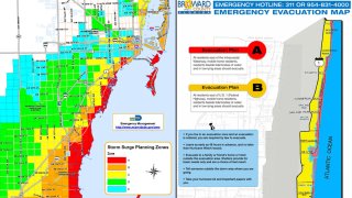
Evacuation Zone: Broward County
All persons residing in low areas near water masses should seek refuge elsewhere if conditions require.
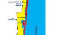
All residents of mobile homes must evacuate if plans A or B come into force.
Evacuation Plan A - for Hurricane Category 1 or 2
- Storm surge is 4-7 feet above sea level with winds from 74-110 miles per hour.
- All mobile home residents, residents beside tidal bodies of water and in low-lying areas, and residents east of the Intracoastal Waterway should evacuate.
Evacuation Plan B - for Hurricane Category 3 or higher
- Storm surge is 7-11 feet above sea level with winds of 111 miles per hour or greater.
- In addition to those required to evacuate under Plan A, all residents east of U.S. 1 (Federal Highway) should evacuate.
In addition, an evacuation order may be issued for residents of mobile homes in the event of a tropical storm if conditions require.
Local

For more information about shelters that are opened for a particular emergency, visit the Broward County Emergency Management Agency website, call 954-831-3900 or dial 311.
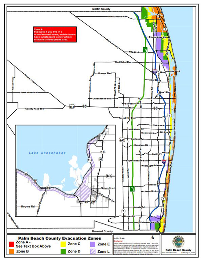
Evacuation Zone: Palm Beach
Category 1 or 2 Hurricanes (Red Zone)
- All barrier islands.
- All mobile homes.
- All properties one block away from the water.
- All areas prone to flooding.
- All areas on Jupiter between: Pennock Road to the east – North of Toney Penna Road east of Military Trail – North of Indian Creek Parkway.
- All areas in Boynton Beach east of US1 / Federal Highway.
Category 3, 4, or 5 Hurricanes (Yellow Zone)
- All areas of US / Federal Highway within the city limits of Boca Raton, Delray Beach, Gulf Stream, Hypoluxo, Lake Park, Riviera Beach and West Palm Beach north of 36th Avenue.
- All areas east of Dixie Highway within the city limits of West Palm Beach (between 36th street and Okeechobee Blvd) and Lake Worth.
- All areas east of the railroad tracks within the city limits of Boynton Beach and Lantana.
For more information about evacuation zones and shelters click here or call 561-712-6470.
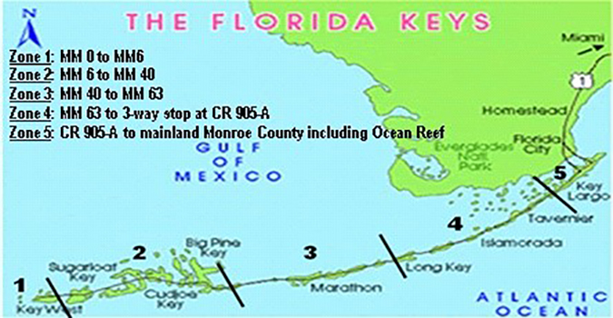
Evacuation Zone: Monroe County
This evacuation plan is intended to avoid unnecessary evacuation in zones that could be affected.
Locate the area where you live so you will know when to head out if your area is being evacuated.
The zones of evacuation are as following:
Zone 1: Mile Marker 0 to Mile Marker 6
Zone 2: Mile Marker 6 to Mile Marker 40
Zone 3: Mile Marker 40 to Mile Marker 63
Zone 4: Mile Marker 63 to three-way stop at CR 905-A
Zone 5 : Three-way stop at CR 905 to Mainland Monroe County including Ocean Reef
For more information about evacuation zones and shelters click here or call 1-800-955-5504.