
Tropical Storm Alex is more than likely being baptized today. It will be the first named storm to form after the official start of the Atlantic hurricane season on June 1st in eight years. The month of May each of the past 7 years had been active in the tropics.
Tropical Storm Warnings are in effect for South Florida as well as the west half of Cuba and the northwest Bahamas. That indicates that tropical storm conditions are expected across the region.
However, the chance of sustained tropical storm force winds for the Miami and Fort Lauderdale as well as the Keys was still low — about a 1 in 5 chance.
Some momentary gusts to tropical storm force, above 38 miles per hour, are still possible. That means that no significant wind damage is expected, and power outages won’t be widespread. Some palm fronds and tree branches may sway and break, so small pockets of blackouts are possible. And isolated tornadoes cannot be ruled out.
Get South Florida local news, weather forecasts and entertainment stories to your inbox. Sign up for NBC South Florida newsletters.
Hurricane Season 2022
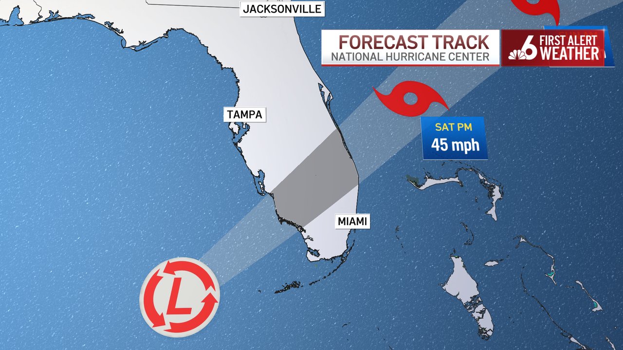

Rainfall accumulation forecasts are slightly lower now because Tropical Storm Alex is expected to cross the Florida peninsula relatively quickly. The center of the storm may only spend 6 hours on Saturday morning crossing from the west coast near Fort Myers to the east coast near Port Saint Lucie.
Most of South Florida will see 4½ to 9½ inches of rain — though I still can’t rule out that some neighborhoods may exceed 10 inches (250 millimeters) of rain, maybe even a foot!
Flooding, therefore, is still the biggest concern with what will be Alex. It’s no secret that urban and flash floods have been happening more frequently in South Florida. Unbridled sprawl over the past couple of decades with little concern for sustainable and environmentally friendly methods of urbanization means that there are more impermeable surfaces, and the rainfall runoff has nowhere to go.
Climate change has also worsened our flooding, as sea level rise has pushed up our water table and has made it harder for the rainwater to flow into the ocean.
The rain had already become widespread this morning across the Florida Keys as well as Miami-Dade and Broward counties. But the excessive rainfall rates that could lead to more serious flooding won’t arrive until later Friday and overnight.
Locations in Florida north and west of the depression’s path wouldn’t get much precipitation, while those east and south of the center could see flash floods. For places like Tampa and Daytona Beach, just to pick two examples in central Florida, it could end up being a bright Saturday.
Significant clearing may be seen as early as Saturday morning. I would not be surprised to see sunshine by Saturday afternoon, given how quickly Tropical Storm Alex is expected to exit the state. Sunday looks pretty, with dry air being pulled from the North American continent southward across Florida.
