
The National Weather Service issued a Severe Thunderstorm Warning on Monday for northern Broward and southeastern Palm Beach counties.
The warning lasts through 5:30 p.m. and impacts Coral Springs, Pompano Beach, Deerfield Beach and Delray Beach.
The wet weather will stick around Monday across South Florida, but it won't do anything to calm the hot temperatures across the area.
Get South Florida local news, weather forecasts and entertainment stories to your inbox. Sign up for NBC South Florida newsletters.
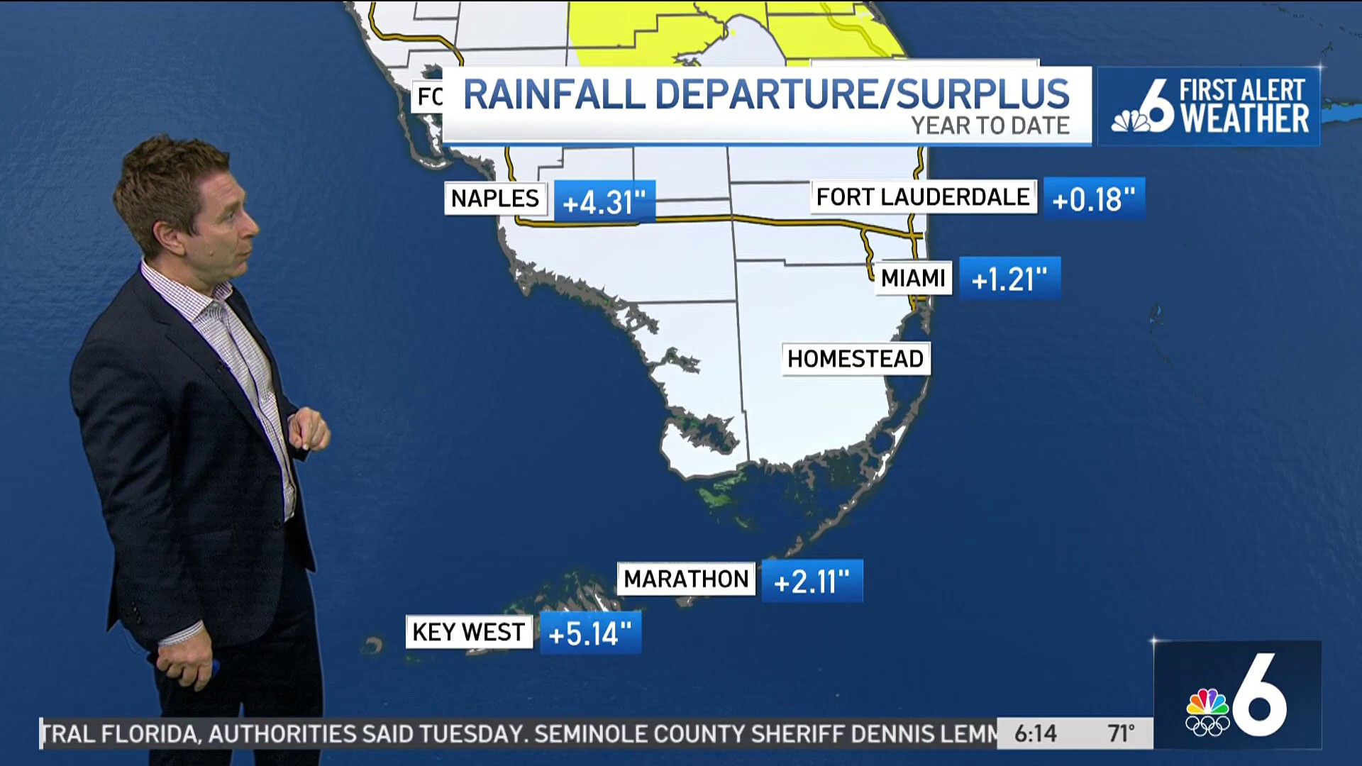
Our stretch of calm weather continues to start the week with mostly sunny skies and light winds Monday morning. Humidity levels are sky high and that will translate into afternoon and early evening storms. Easily half of us will get wet as a Flood Watch is in effect for both Miami-Dade and Broward through Tuesday evening.
It'll be very warm with highs in the low 90s. Feels like temperatures will be well above 100. This pattern will continue right through the first half of the week,
Rain chances wind down a little by late week and weekend with 30-40% rain chances. It'll still be hot with highs in the low 90s.

Tropical Storm Alex is bringing tropical storm conditions to Bermuda and will continue to do so all day Monday. Tropical storm warnings are posted for the island. The cyclone is hustling to the east quickly and will be in the rear view mirror by Tuesday. The rest of the tropics are quiet.
