


What to Know
- Tropical storm Laura's winds reached 50 miles per hour Saturday
- The storm continued to bring heavy rains to portions of Puerto Rico as it made its way across the Greater Antilles
- A Tropical Storm Watch has been issued for the Florida Keys
A Tropical Storm Watch has been issued for the Florida Keys, as Tropical Storm Laura makes its way towards the Dominican Republic Saturday evening, while Tropical Storm Marco continued to strengthen and is expected to become a hurricane.
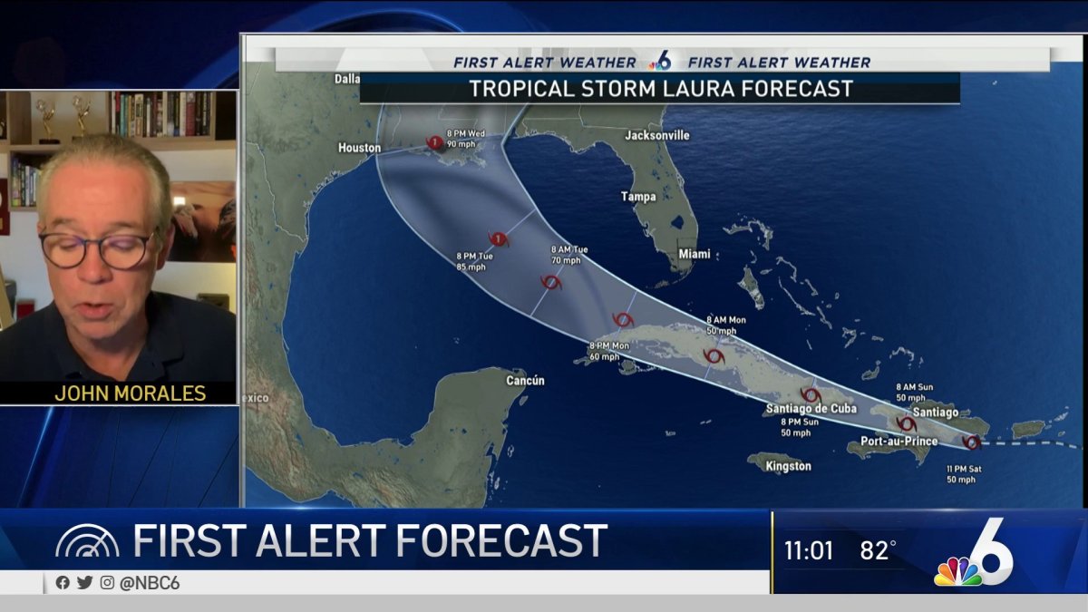
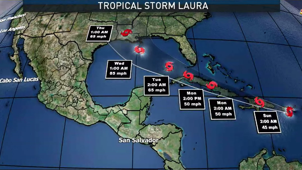
Laura had maximum sustained winds of 50 mph and was moving west at 16 mph about 25 miles southeast of Santo Domingo, Puerto Rico, according to the 11 p.m. update from the National Hurricane Center in Miami.
HURRICANE SEASON 2020

The storm is expected to leave up to 12 inches of rain as it passes through the southern part of the Dominican Republic and Haiti overnight Sunday, potentially leading to life-threatening flash and urban flooding, mudslides and river flooding.
Laura will then make its way to eastern Cuba by Sunday night. Officials in Cuba have issued a tropical storm watch for the provinces of Las Tunas, Holguin, Guantanamo, Santiago de Cuba and Granma.
A Tropical Storm Watch has been issued for the Florida Keys from Ocean Reef to Key West, and for the Dry Tortugas, including Florida Bay. Parts of the Keys could take a hit between Monday and Tuesday.
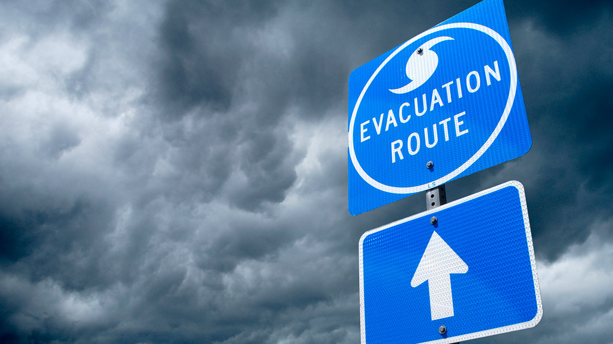
Monroe County issued a state of local emergency Friday and will open up the county's Emergency Operations Center in advance of the storm's potential track, officials said. A mandatory evacuation order has also issued for all liveaboard vessels, mobile homes, recreational vehicles, travel trailers, and campers.
Tropical storm warnings were in effect for the southeastern Bahamas and Turks and Caicos Islands, Puerto Rico, Viegues and Culebra, the Dominican Republic and the U.S. Virgin Islands.
A tropical storm watch was in effect for central Bahamas in addition to the Cuban provinces. Rainfall between one and eight inches was expected across the Caribbean.
Stay up to date with NBC 6 First Alert Weather and South Florida's most powerful radar First Alert Doppler 6000 by downloading the NBC 6 app for iOS or Android.
Meanwhile, Tropical Storm Marco continued to strengthen quickly Saturday and had maximum sustained winds of 65 mph as it moved north-northwest at 13 mph about 110 miles west of the western tip of Cuba.
Marco is expected to continue heading up the Gulf throughout Sunday, reaching the northern Gulf Coast on Monday. The storm will then slow down and move west Monday night, across southern Louisiana and into eastern Texas.
A Hurricane Watch is in effect for Intracoastal City Louisiana to the Mississippi/Alabama border.
If both storms survive the weekend, the National Hurricane Center forecast that Laura would as head a hurricane toward the central Gulf Coast around Louisiana, Mississippi, Alabama and the western Florida Panhandle, while Marco aimed at Texas, though most likely remaining a tropical storm.
“A lot of people are going to be impacted by rainfall and storm surge in the Gulf of Mexico,” said Joel Cline, the tropical program coordinator for the National Weather Service. “Since you simply don’t know you really need to make precautions.”
Two hurricanes have never appeared in the Gulf of Mexico at the same time, according to records going back to at least 1900, said Colorado State University hurricane researcher Phil Klotzbach. The last time two tropical storms were in the Gulf together was in 1959, he said.
Because the hurricane center slowed Laura's entrance into the Gulf and moved its track westward, the two storms are now forecast to be together in the Gulf on Tuesday, just before Marco smacks Texas with Laura making landfall a bit less than a day later.
If the two storms make it, they could be crowded in the Gulf of Mexico at the same time Tuesday about 550 miles apart. That would leave open some weird possibilities, including the storms rotating around each other in a tropical two-step, pulling in closer to each other, nudging each other, weakening each other or — far less likely — merging.

