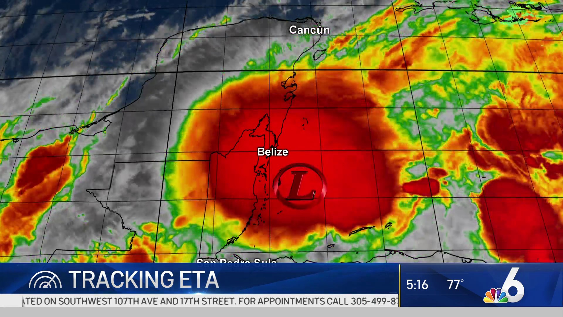
WATCH LIVE: The latest imaging and expected forecast track for Eta are in the player above
As the remnants of hurricane Eta moved back over Caribbean waters and was expected to bring some wet and windy weather to South Florida, governments in Central America worked to tally the displaced and dead, and recover bodies from landslides and flooding that claimed dozens of lives from Guatemala to Panama.
Friday morning, Tropical Depression Eta had maximum sustained winds of 35 mph and was moving north-northeast at 7 mph, according to the National Hurricane Center in Miami. The forecast had it strengthening to a tropical storm Friday night before nearing the Cayman Islands Saturday and crossing Cuba Sunday. From there it could reach Florida or at least come close enough to assure heavy rains.
South Florida remained in Eta's cone of concern Friday, and will likely deal with added moisture, significant rain and storm chances, and the risk of flooding early next week.
With the possibility of up to 10 inches of rain over the next five days, a flood watch has been issued for South Florida's metro areas, beginning Friday night and lasting through Tuesday evening. Additionally, with gusty winds expected, a wind advisory will go into effect Friday night and last through 6 a.m. Saturday.
As the weekend progresses, expect the trend of numerous heavy showers and storms to continue and as Eta nears the winds could increase. Depending on the exact track of Eta, isolated tornadic activity cannot be ruled out as we get into the overnight hours of Sunday into Monday with Tropical Storm Eta nearby.
It will be days before the true toll of Eta is known. Its torrential rains battered economies already strangled by the COVID-19 pandemic, took all from those who had little and laid bare the shortcomings of governments unable to aid their citizens and pleading for international assistance.
Shortly after Honduran President Juan Orlando Hernández asked neighboring Guatemala for help rescuing residents stranded near their shared border Thursday, Guatemalan President Alejandro Giammattei said at least 50 people had been killed in landslides in his own country, most of them in a remote town rescuers struggled to reach. Guatemala’s national emergency agency later said only that at least 50 people were missing in San Cristobal Verapaz.
The U.S. National Hurricane Center had forecast that parts of Nicaragua and Honduras could receive 15 to 25 inches of rain, with 40 inches possible in some isolated parts.
A week of rain spoiled crops, washed away bridges and flooded homes across Central America. Hurricane Eta’s arrival Tuesday afternoon in northeast Nicaragua followed days of drenching rain as it crawled toward shore. Its slow, meandering path north through Honduras pushed rivers over their banks and pouring into neighborhoods where families were forced onto rooftops to wait for rescue.
Marta Julia Portillo, 62, fled her San Pedro Sula neighborhood before dawn Thursday with relatives. They paused at a gas station on dry ground until they were told to move on.
“We don’t know where to go because we don’t have any place to shelter,” she said. Her son, who stayed behind at the family home, told her water was up to the third floor.
“I would say the national capacity has been overwhelmed by the size of the impact we are seeing,” said Maite Matheu, Honduras director for the international humanitarian organization CARE. The group was using its network of contacts in Honduras to identify the hardest-hit areas and catalogue their most-pressing needs.
Honduras Foreign Affairs minister Lisandro Rosales said via Twitter that “the destruction that Eta leaves us is enormous and public finances are at a critical moment because of COVID-19, we make a call to the international community to accelerate the process of recovery and reconstruction.”
Observers are already anticipating that the havoc wrought by Eta will pressure more people to migrate from countries that are already some of the primary senders of migrants to the United States border in recent years.
“Now with this situation, this is going to be an exodus, a massive exodus of migrants toward the north,” said Matheu.
WEATHER
“Whatever comes out (of Central America) is going to linger awhile,” said Colorado State University hurricane researcher Phil Klotzbach. “I’m not convinced we’re done with Eta.”
That’s because what’s left of Eta still has spin, which is hard to kill off, and that should help it reform, said NOAA hurricane and climate scientist Jim Kossin.
Once it reforms and heads toward Cuba, it could meander in the area for awhile. Tropical storm warnings and watches were issued Friday afternoon for parts of Cuba and the Cayman Islands, where Eta is expected to produce 8 to 16 inches of rain with Isolated maximum totals of 25 inches.
“The winds aren’t going to be the problem. The rains are going to be the problem,” Klotzbach said.
Eta will be so big, wet and messy that it doesn’t have to make landfall in already rain-soaked South Florida to cause a mess, Klotzbach said.
“Slow-moving sprawling ugly tropical storms can certainly pack a precipitation wallop even if it doesn’t make landfall,” Klotzbach said.


