
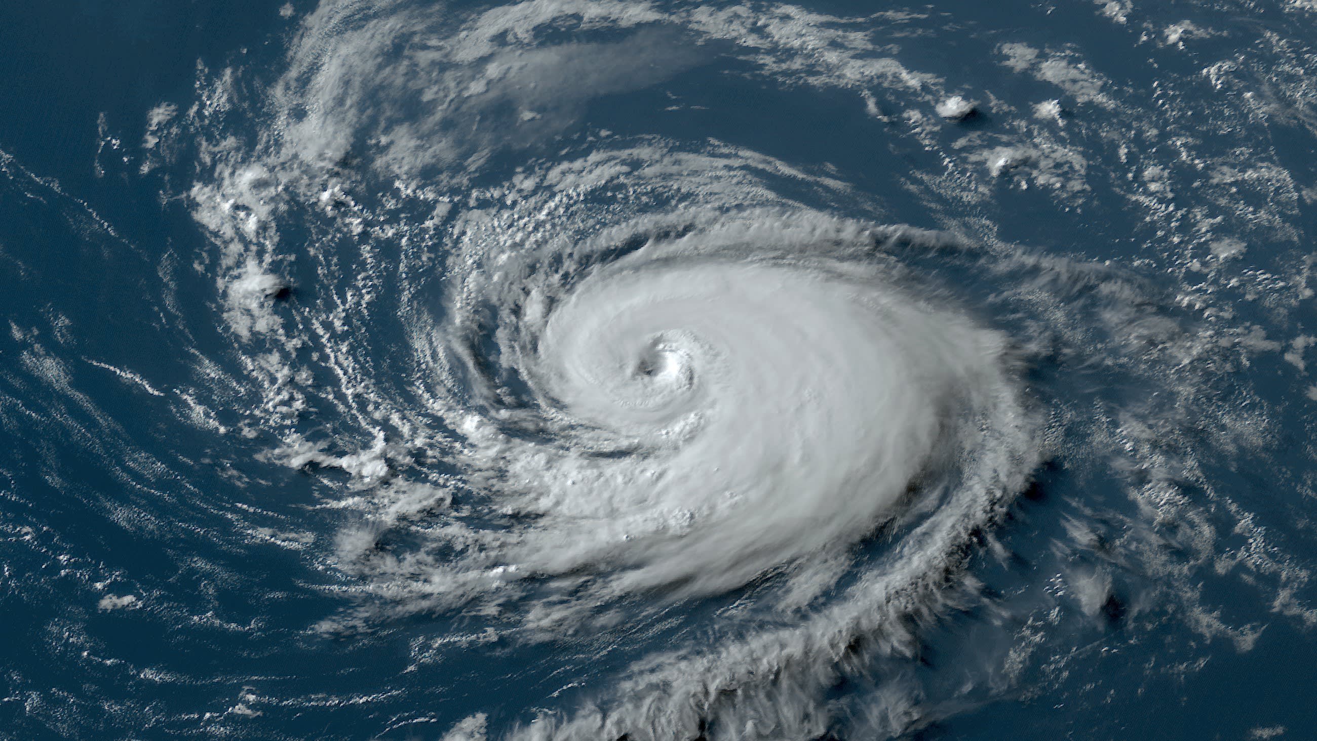
Idalia has been warming up at the starting blocks near the western tip of Cuba.
In an environment with little wind shear and superheated water, the hurricane has been gradually gaining strength. The hot water extends beyond the sea surface to a significant depth, so that even as the wind churns up the Caribbean Sea underneath, the water being upwelled in and near the Yucatan Channel is still quite warm and able to fuel Idalia. Satellite images on Monday showed the structure of the storm to be improving.
Water temperatures are going to play a key role when Idalia moves into the Gulf of Mexico on Monday night and Tuesday. Under normal circumstances, it would be difficult to determine how much weight to give warm water fueling a storm versus a marginally hostile wind shear environment, which is still expected for parts of Idalia’s forecast track.
But these are not normal circumstances.
Get South Florida local news, weather forecasts and entertainment stories to your inbox. Sign up for NBC South Florida newsletters.
The Gulf waters are at their all-time hottest for the date, in good part because of unrelenting manmade global warming that led to the hottest summer in recorded history. Models respond to this high-octane fuel with increasing consistency in their projections that Idalia will undergo rapid intensification and reach major hurricane status before striking Florida.
And so, here we go again, another major hurricane with a huge storm surge is forecast for Florida’s Gulf Coast. Impacts are going to be felt as early as Tuesday, and residents of the warned areas need to rush preparations to completion Monday.
Hurricane Season
The NBC 6 First Alert Weather team guides you through hurricane season
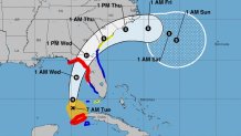
A hurricane warning is in place from Sarasota to the Florida Panhandle south of Tallahassee. The warning includes all of Greater Tampa Bay, which sits at the edge of the National Hurricane Center's forecast track cone.
The "bad side" of the hurricane will be the one impacting almost the entirety of Florida’s west coast, therefore a tropical storm warning stretches from south of Sarasota, past Fort Myers and Naples to the area near Everglades City. Even the Lower Florida Keys are under a tropical storm watch for the possibility of some impacts on the outskirts of Idalia.
To illustrate how dangerous and potentially deadly impacts from a major hurricane can extend beyond the hurricane-warned area, the storm surge warning extends south of Sarasota to Englewood, abeam Port Charlotte. A storm surge watch is in effect south of there to the Everglades City area too.
The arrival time of the hurricane is also a very important factor. If NHC’s 11 AM Monday forecast were to be 100% accurate — which would be a rarity given we’re still two days out — Idalia's eye would be abeam Tampa Bay in the predawn hours of Wednesday, then head towards Florida's sparsely populated Nature Coast for a mid-morning Wednesday landfall.
If it really were to arrive in the early- to mid-morning, that would coincide with low tide, and storm surge would be somewhat mitigated. However, storm surge doesn’t happen in a single moment in time, and many parts of the west coast will deal with storm surge through multiple tide cycles on Tuesday and Wednesday.
Idalia hitting the coast as a major hurricane also means a buzzsaw of wind damage for those in the path of the eyewall. Studies show that in this new era of hyper-intense hurricanes, wind damage can extend further inland. In this case, that could mean deep into Florida and even Georgia.
Rainfall from Idalia for most of Florida and beyond will amount to 4 to 8 inches, though those closer to its center may see a foot. Tornadoes will be possible too, as far south as southern Florida.
For the Miami-Fort Lauderdale-Palm Beach megalopolis, other than the non-zero risk of tornadoes on Tuesday, the official forecast calls for only a modest impact from winds. Gusts could reach 30 to 40 miles per hour.
Rainfall, however, is much more uncertain. While the official forecast calls for 2 to 4 inches, if a feeder band from the distant hurricane aligns itself at just the right spot, we could get significantly higher accumulations. I don’t need to remind you of the multiple 1-in-100 or 1-in-500 year rain events we’ve seen in the last few years.
Another "I" storm has a chance to become infamous. Let’s hope it doesn’t.
John Morales in NBC6's hurricane specialist.
