
Editor's Note: This story was originally published in June 2015 and has been updated as part of coverage of Hurricane Matthew.
The last time southern Florida faced down a hurricane's full wrath was more than a decade ago.
Since then the state has grown by at least 2.5 million people. Many newcomers may be unprepared for the punishing winds and surges of water that come with a direct hit, and not used to boarding up their windows or evacuating their homes.
That worries professional hurricane watchers.
“There are going to be people who have moved to the state and don’t know what to do, how well to prepare for a hurricane,” said David Nolan, the chairman of the Department of Atmospheric Sciences at the University of Miami’s Rosenstiel School of Marine and Atmospheric Science.
Others who experienced a hurricane may have forgotten how to prepare for one or become complacent, he said.
Local


While Hurricane Hermine struck North Florida earlier this year, the last hurricane to hit southern Florida was Wilma in 2005. It killed 25 people, left most of South Florida without power and cut a broad swath of damage in Broward, Miami-Dade and Palm Beach counties.
Hurricane Matthew made landfall in Haiti on Tuesday morning and is heading toward Cuba and the southeastern coast of Florida. The National Hurricane Center issued a hurricane watch for South Florida late Tuesday morning.
Gov. Rick Scott warned residents to take the storm seriously, adding "we cannot rule out a direct hit."
The 2005 Atlantic hurricane season was the most destructive for the United States, largely because of Hurricane Katrina two months earlier, according to the National Oceanic and Atmospheric Administration or NOAA. Katrina alone caused $151 billion in damage and killed 1,833. In all, seven named storms made landfall in the United States during 2005, and eight the year before.
Why was there a flurry of storms in Florida and then none?
“I don’t think anyone can give a specific answer to that,” Nolan said. “Hurricane activity has been reduced a lot in the last 10 years.”
In addition, in the last few years, the jet stream has dipped over the East Coast, bringing cold and stormy winters — a weather pattern that can draw storms such as Sandy up to the Northeast and away from Florida, he said.
Hurricanes are very unusual, so 10 years without one is not that odd, he said. Florida had a long period of little hurricane activity in the 1970s and 1980s until Hurricane Andrew hit in 1992, destroying homes and downing power lines from Fort Lauderdale to the Florida Keys. Five thousand people were left homeless.
Elliott Stares, 42, is among the newcomers to Florida. Originally from the United Kingdom, the public relations consultant with his own firm moved to South Beach 14 years ago. He and his wife are creating a "go bag" for an emergency evacuation from their Miami neighborhood.
"Since I've been here, I've been lucky enough not to experience a direct hit like Andrew," said Stares, who became a citizen in March.
If an evacuation is mandatory and there is enough time, they would try to reach his wife's parents in Dallas, he said.
The condominium complex where he lives has hurricane-proof windows so he feels it is "pretty well battened" for a mild storm.
"But anything from 3 and above, based on the authorities' advice on evacuating, then we would oblige," he said.
The number of hurricanes predicted for the 2016 Atlantic hurricane season called for a near-normal season with 10 to 16 named storms, with four to eight hurricanes and one to four "major" ones.
Officials cautioned in 2015 that even a below-normal season can still be devastating and pointed to 1992, when only seven named storms formed but the first was Andrew, a Category 5 hurricane. Category 5 storms — the most powerful classification — have sustained wind speeds on 157 miles per hour or more and cause catastrophic damage.
Because of Andrew, Miami-Dade County has some of the toughest building codes in the country, particularly for wind, said Brian Haus, professor of Ocean Sciences at the University of Miami’s Rosenstiel School. But the state’s housing is a mix of old and new, and many of the coastal areas were built before there were strong storm surge codes, he said.
“So many coastal buildings in the older areas are not elevated,” he said. “They need to be.”
Late in 2014, the school opened a new research complex that includes a hurricane wind-wave tank that can generate Category 5 hurricane-force winds. Researchers are trying to get better data on the effects of wind and water surges, not only on individual buildings but on neighboring structures as well. Driven by intense winds, the seawater exerts extreme force on buildings, he said.
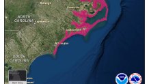
During the 2015 hurricane season, the National Hurricane Center introduced a new graphic specifically for storm surges in addition to one for wind speeds. The center will issue separate storm surge watches and warnings separate from the hurricane watches and warnings it has traditionally broadcast. A watch is defined as the possibility of life-threatening flooding within 48 hours; a warning, within 36 hours.
The graphic complements a potential storm surge flooding map, released during Hurricane Arthur in 2014, which shows where inundation could occur and how high above group the water could potentially reach.
A surge of seawater is often the greatest threat. It can occur at different times and places than a hurricane’s winds and well inland from the coast and might require evacuation.
Hurricane Ike — which devastated the Bolivar Peninsula of Texas and caused widespread damage in other areas of southeastern Texas, Louisiana and Arkansas in 2008 — was the impetus for the emphasis on storm surges, said Jamie Rhome, the leader of the National Hurricane Center’s Storm Surge Unit.
More recently Hurricane Sandy focused the public’s attention on the damage that could result. Though only a Category 1 when it made landfall in southern New Jersey in 2012, with sustained winds of 74 to 95 miles per hour, Sandy was a massive storm that did $67 billion in damage from flooding, according to NOAA. The storm surge — the rising seawater that results from wind and changes in atmospheric pressure — pushed water inland.
Recent research shows that storm surges are the primary killers during hurricanes, but polling indicates that the public believes otherwise, Rhome said.
“People really only think wind when they hear hurricane, they’re primarily focused on wind, yet it’s water that’s resulting in the largest loss of life,” he said. “That disconnect is what we’re really seeking to tackle with these new maps.”
As far as Florida’s hurricane-free streak?
“I guarantee you that remarkable streak is going to end,” said Dennis Feltgen, a spokesman for the National Hurricane Center in Miami. “And we have to go into 2015 assuming that it’s going to end this year.”
