
Water, water everywhere, but no way to put in.
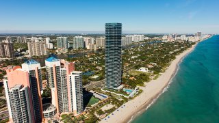
That’s often the case in Miami-Dade County, blessed and cursed with hundreds of miles of mostly publicly inaccessible waterways, from the Biscayne Bay shoreline to lakes natural and artificial and rivers and canals that stretch to the edge of the Everglades.
Now Miami-Dade’s parks department has some ideas to get you and your boat, kayak or paddleboard in that water — and it thinks you might, too.
It has launched a public effort to devise a plan for a system of “blueways” to provide new public entry points to the water along the bayfront and lake and canal banks, opening up previously out-of-reach spots for use by boaters and paddlers and even splashers.
Get South Florida local news, weather forecasts and entertainment stories to your inbox. Sign up for NBC South Florida newsletters.
The improvements could range from the basic, like a rustic canoe or kayak launch at a place where a neighborhood street dead-ends at a canal, to a full-fledged recreational area at water’s edge with a range of amenities like restaurants and shopping, park planners say. It could also mean expanding and improving access at existing marinas and boat ramps, where heavy weekend and holiday demand can often swamp capacity.
One focus of the effort, planners say, will be facilitating access to the water for disabled people and the economically disadvantaged. Another: Adapting to climate change.
What goes in the plan will be in large part up to you: Parks officials are asking the public to fill out a detailed online survey that aims to establish what kind of access people want and where, how elaborate the facilities ought to be, and how much they’re willing to pay for them.
Local

Armed with that information, the planners and a steering committee appointed to oversee the plan hope to propose specifics by early 2021. The resulting blueprint could carry some extra weight because it’s a joint effort with the Florida Inland Navigation District, an obscure state agency that quietly funds millions of dollars’ worth of public waterfront improvements along the Intracoastal Waterway through a small line item on property tax bills.
The blueways initiative is an outgrowth of a 50-year parks master plan, approved by the county in 2008, that set an ambitious goal of putting a park or green space within a short walk of every resident of sprawling Miami-Dade.
The plan, which the county has been gradually implementing, goes well beyond the traditional passive and recreational gems, like Crandon Park on Key Biscayne and Tropical Park in unincorporated Westchester, that have been the backbone of Miami-Dade’s parks system, one of the largest in the nation. The county manages parks big and small in unincorporated areas, as well as larger regional parks in some municipalities, including the 630-acre Matheson Hammock on the bayfront in Coral Gables and the 515-acre Amelia Earhart Park in Hialeah, which has five lakes and a network of mountain-bike trails.
The broad master plan calls for connecting those parks to natural areas and new open spaces through interlinked greenways, such as bike and walking trails, and improving facilities at existing parks to attract a wider range of users, especially in disadvantaged areas. Because of the high cost of acquiring land, the county agency — which has an annual capital budget of around $80 million — has been focusing on existing public rights of way as it fills in the plan, creating “linear parks” and trails along canal banks, roads and even utility corridors that carry powerlines.
The master plan’s products range widely, including Roberta Hunter Park, a long, narrow green park with a walking and running path that extends about a mile from U.S. 1 north to Quail Roost Drive in South Miami-Dade; new, nature-oriented playgrounds at Camp Matecumbe in West Kendall and at Biscayne Shores and Gardens Park in an unincorporated area near Miami Shores and Biscayne Park, and the new Father Gerard Jean-Juste Community Center at Oak Grove Park in Northeast Miami-Dade.
The county now also boasts around 160 miles of trails through areas urban and natural, with more in development, Cornely said. Those include substantial segments of the planned canal-side Biscayne Trail and Black Creek Trail in South Miami-Dade, which connect at the county’s Black Point Park and Marina. A 1.5-mile trail under Florida Power & Light lines in West Miami-Dade is in the planning stages.
When completed, the planned Snake Creek Trail will link the Dadeland North Metrorail station to South Miami’s Dante Fascell Park. It would also connect to the Ludlam Trail along a disused rail corridor that runs north to Miami International Airport, and the planned conversion of the bare-bones path running beneath the elevated Metrorail line into the Underline, a 10-mile green trail for people on foot and on bikes. Construction has begun on the first phases of both the Ludlam Trail and the Underline, which have received substantial county support.
In the same way, county parks planners hope to create a system of formal, designated blueways or water trails close to home for people living far from Biscayne Bay, where most public access to the water is now located. That would provide them an alternative to driving to the bayfront, as well as ease pressure on the bay, which is struggling from heavy use and polluting runoff, said Jack Kardys, a planning consultant for the county and retired Miami-Dade parks director, at a workshop last week.
“We can relieve the pressure on environmentally sensitive areas,” Kardys said.
Given the far reach of the county’s system of canals and lakes, the opportunities are almost endless. Kardys noted that the Snapper Creek canal extends all the way to Florida International University on Southwest Eighth Street and beyond that to the Everglades.
The blueways could even provide transportation routes for water taxis or water transit, Kardys said.
The South Florida Water Management District, which controls the canal system, once forbade or discouraged use of canal banks, but has in recent years opened them up to the public. The rough paths along them have proven popular with off-road bicyclists who can pedal on them uninterrupted for miles, though the canal banks provide no amenities.
Under the parks master plan, the county has begun formalizing some of those trails, smoothing them out, in some cases paving them and providing signage, water fountains and other amenities. One of the most ambitious elements in the plan is a 40-mile trail loop that would some day connect Biscayne National Park on the bayfront to the Flamingo entrance of Everglades National Park in deep Southwest Miami-Dade.
If the master plan is fully implemented, it would — at least in theory — be possible to one day circumnavigate or cross Miami-Dade on foot, by bike or human-powered boat, or some combination of those, on designated green or water trails.
