
With the passage of Isaias, South Florida will move into a wet forecast pattern due to a trail of moisture moving into the region.
Afternoon showers and storms will return Monday until mostly cloudy skies. There should be some sunshine in the morning to start the day, helping afternoon highs to climb into the lower 90s.
Tuesday and Wednesday will be just as wet with showers and storms expected. Still, highs reach to around 90 degrees.
In fact, each day this week will hold a decent chance for rain, with Wednesday being the day where the wet weather is most widespread.
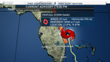
There are no tropical concerns in the Atlantic at this time, allowing us a needed break in the hurricane season.
Keep updated with the NBC 6 First Alert Weather team and First Alert Dopper Radar here.

