
June is Bustin’ Out All Over. The ocean is full of Jacks and Jills.
Except Jack and Jill are Bret and Cindy in 2023.
The title of this 1945 song from the Broadway musical Carousel by Rodgers and Hammerstein made me think of what’s going on right now in the tropical Atlantic.
It’s just busting out.
Get South Florida local news, weather forecasts and entertainment stories to your inbox. Sign up for NBC South Florida newsletters.
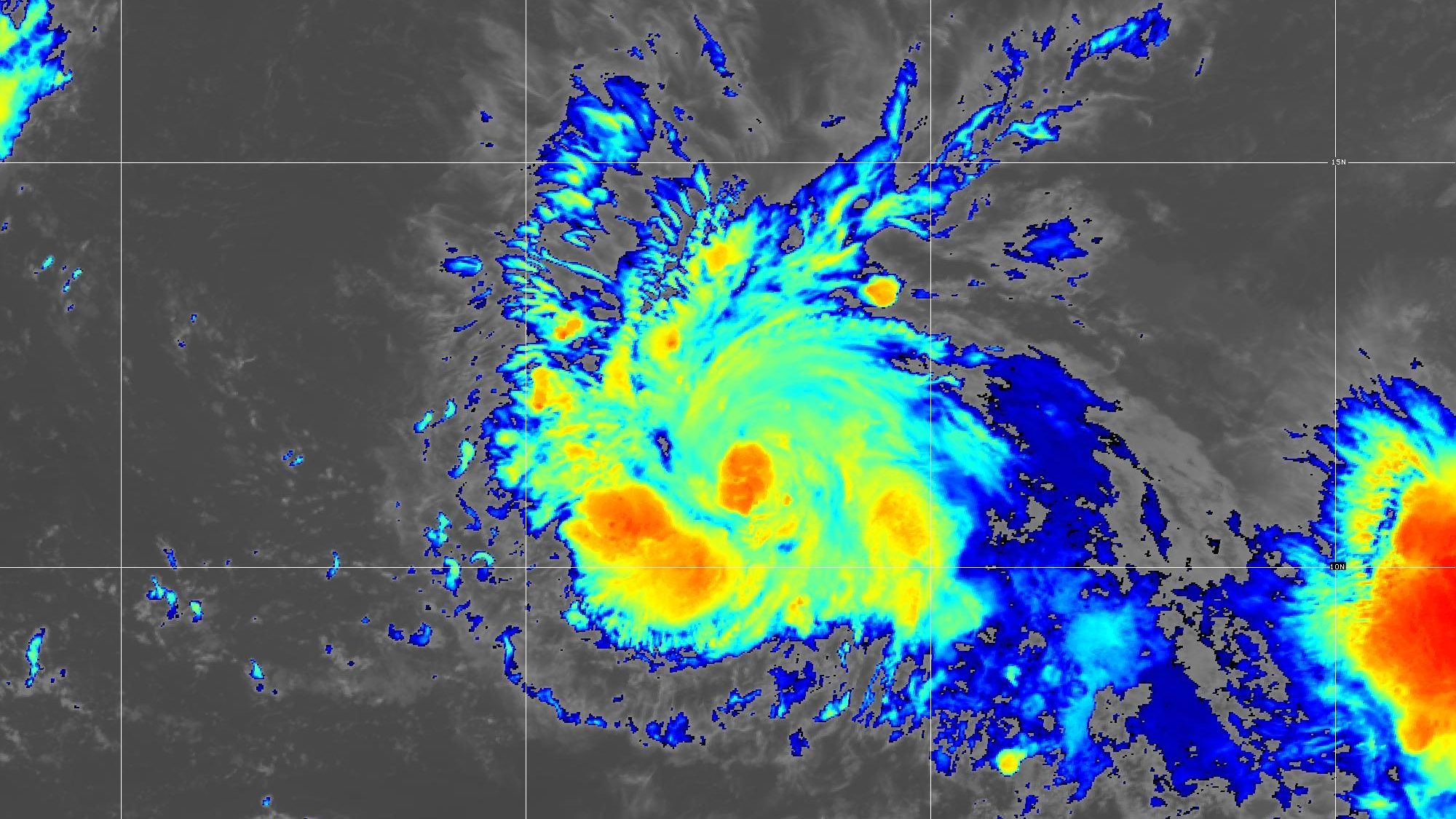
The satellite picture shows an absurd three tropical disturbances lined up between the Caribbean and Africa, all moving towards the west.
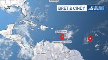
The one closest to the islands is Bret, which is passing near Barbados and between Martinique and Saint Lucia this Thursday evening just under hurricane strength. Up to 10 inches of rain are forecast from Guadeloupe south to Saint Vincent and the Grenadines, with the risk of flash flooding. Tropical storm force winds were likely, and there was still a chance for hurricane conditions in some of the islands.
HURRICANE SEASON
Bret is not expected to last long once it moves past the Lesser Antilles. Increasing wind shear brought by a dip in the jet stream should start to weaken the tropical storm. It could be close to dissipating by the time it’s moving westward over the central Caribbean Sea between Venezuela and Hispaniola.
A sideswipe by Bret of some of the Greater Antilles wouldn’t necessarily have been a bad thing. El Niño often leads to drought in the Caribbean, and it’s already quite dry in parts of the Dominican Republic and Puerto Rico.
Behind Bret is Tropical Storm Cindy, located midway between the Cabo Verde and the Windward islands. Cindy’s track is forecast to lean more towards the open North Atlantic, meaning that it’s likely to miss the islands entirely. Wind shear is also expected to play a role, and Cindy is not forecast to be able to reach hurricane strength.
Keep in mind that the third named storm in the Atlantic doesn’t normally form until August 3! We are six weeks ahead of schedule, thanks in good part to the silly-hot water across the Atlantic Ocean. Tropical cyclones need, and derive their energy, from the warm sea surface.
There is yet another vigorous tropical wave rolling off the west coast of Africa which, so far, has not been mentioned by the National Hurricane Center (NHC) as a candidate to become a new depression or storm. But given the current setup in the main development region of the Atlantic, don’t count out that possibility.
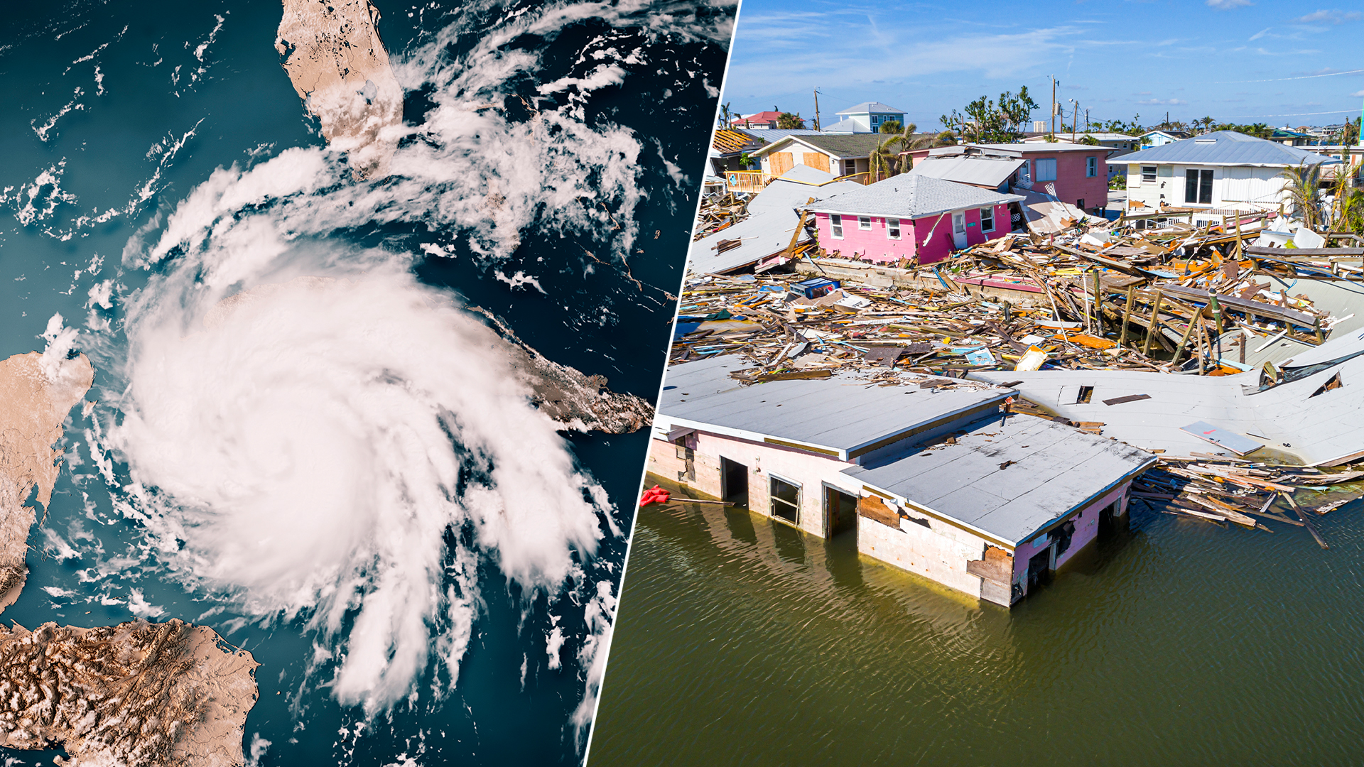
Let me go back to 1945, the year when the song June is Bustin’ Out All Over was first sung on Broadway. That year, a major category 4 hurricane struck Homestead, Florida, on September 15, “bearing many similarities in size, track, and impact to 1992’s Hurricane Andrew,” according to NHC’s re-analysis of the 1941 to 1945 Atlantic hurricane seasons.
Thankfully, there are some pretty big differences between the 1945 and the 2023 seasons.
1945 was an ENSO-neutral year, meaning that the El Niño Southern Oscillation was neither in El Niño or La Niña phase. In 2023 we’ve entered an El Niño phase, and the phenomenon is expected to become very strong by fall. The 2023 El Niño should produce lots of days when wind shear will limit hurricane formation and strength.
Is the other big difference between 1945 and 2023 going to play a role this season?
In 1945 we were enjoying the last few years of the 12-thousand-year-long Holocene Epoch, when the climate became essentially perfect for mankind to flourish.
Those days are over.
A growing group of scientists argue that 2023 is part of the Anthropocene Epoch, marked by the human activities that are impacting the planet. One of those impacts is global heating.
The oceans have absorbed most of the heat being trapped by increase in greenhouse gases produced by the burning of fossil fuels. And that’s part of the reason that the tropical Atlantic is so warm, so soon.
For now, Floridians should be happy that neither Bret or Cindy, or Jack or Jill, will be heading this way.
John Morales is NBC6's Hurricane Specialist.
