
In a hurricane season full of surprises, we may see another yet.
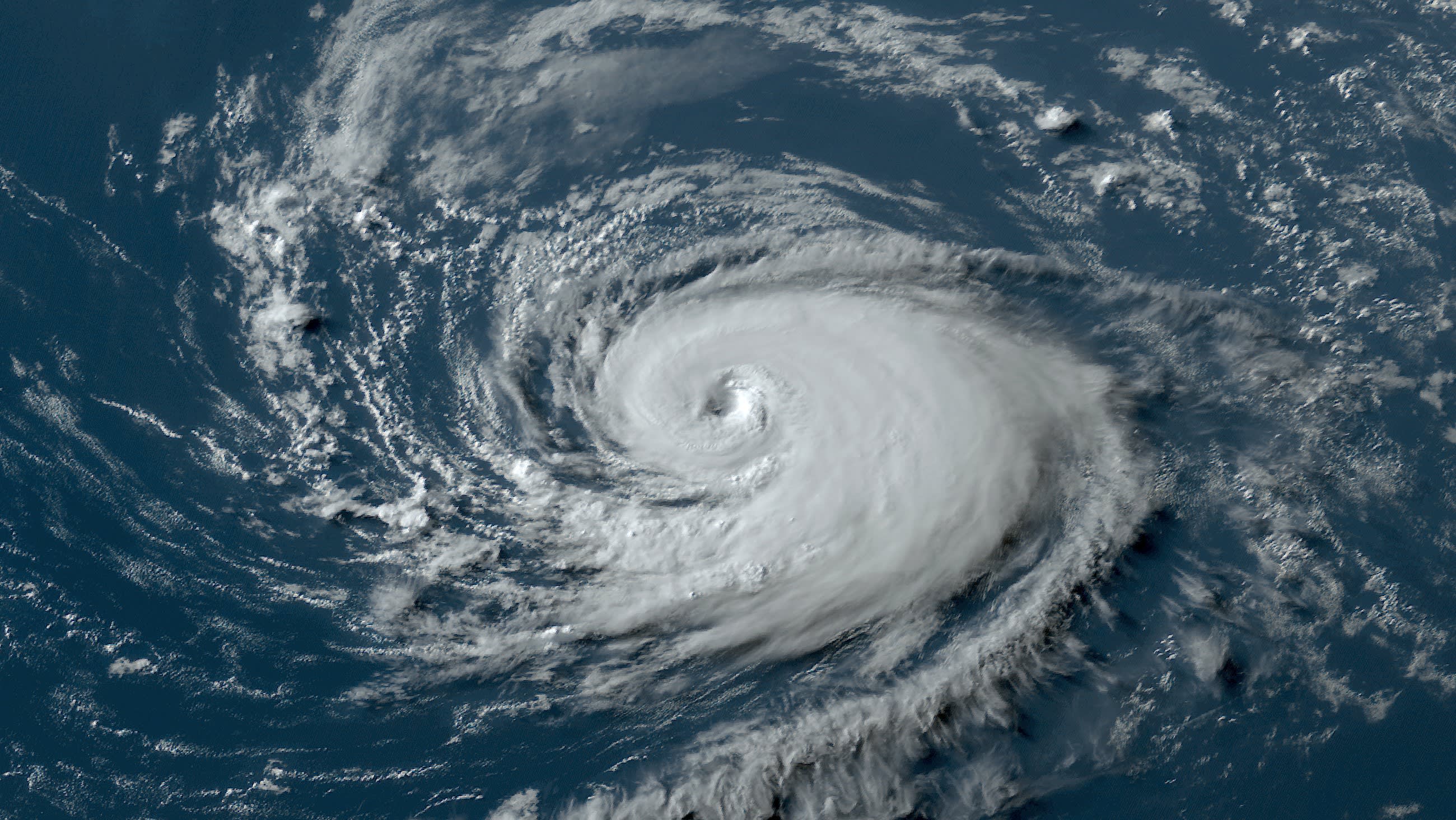
A tropical disturbance with a high chance of developing into a tropical depression or storm sat south of the Cabo Verde islands on Friday. The Cape Verde portion of the season ended on September 30. But just like it can rain in Miami even after rainy season ends, there can be October hurricanes in the Main Development Region (MDR) of the Atlantic between the Caribbean and Africa. It’s just rare.
Fewer than 5% of all hurricanes that form in the MDR do so after October 13. And yet, several reliable weather models are indicating that a tropical storm could form in the next several days at a spot closer to the equator than the Tropic of Cancer. Because of its more southern location, the potential storm could manage to travel several hundred miles westward before being picked up by a front or dip in the jet stream. The storm could travel along with the trade winds, from east to west, eventually threatening the eastern Caribbean islands.
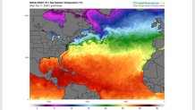
You might have already guessed what is causing this. That’s right: a record-hot Atlantic Ocean. Averaged sea surface temperatures in the Atlantic this week were much hotter than they would normally be not just in mid-October, but even for September 1st near the peak of hurricane season. The water along the path of that disturbance is at or above 86 degrees.
Get South Florida local news, weather forecasts and entertainment stories to your inbox. Sign up for NBC South Florida newsletters.
There are, of course, no guarantees that this tropical wave will turn into a storm or hurricane. The National Hurricane Center on Friday morning gave it a 70% chance over the next seven days, when wind shear is expected to diminish in the MDR. If it were to develop, its closest point of approach to the eastern Caribbean would be next weekend, after the 20th. Even if it develops, there is also still a chance that it will recurve northbound before reaching the Antilles. It’s just too soon to tell.
This late forming system in an area where the water would normally be too cold by now, along with the storms that formed very early this season in the same region — namely Bret and Cindy — remind us of how hurricane seasons of late just don’t seem to be following "the rules."
Hurricane Season
The NBC 6 First Alert Weather team guides you through hurricane season
A study published two weeks ago in the prestigious journal Nature identified a seasonal advance of intense tropical cyclones since the 1980s in most oceans, at a rate of nearly 4 days per decade in the Northern Hemisphere. Remember all the May storms that have formed in the Atlantic in recent years? Heck, we had a January subtropical storm form off the east coast of the U.S. this year!
Hurricanes nowadays are also able to remain stronger into northern latitudes thanks to the steady climb in water temperatures. Sometimes, of late, we also see storms retain tropical characteristics longer and wallop western Europe. And, as I’ve explained in the past, many more storms today undergo rapid intensification cycles which turn them into monster category 4 & 5 hurricanes.
2023 was was supposed to be a slow season because of El Niño. It’s been anything but.
John Morales is NBC6's hurricane specialist.
