
Topical Depression 28 formed over the Caribbean Saturday afternoon and is expected to strengthen into a named storm by Sunday, the National Hurricane Center reported on Saturday.
The Depression is currently located 240 miles south-southeast of the western tip of Cuba, with maximum sustained winds of 35 mph, according to an 11 p.m. update by the National Hurricane Center in Miami.
Tropical Depression 28 will continue moving north-northwest, reaching the southern portion of Cuba on Sunday, where it will form into Tropical Storm Zeta - the 27th named storm of the 2020 Hurricane season.
Meteorologists forecast that the storm will eventually turn into a Hurricane by Tuesday over the southern Gulf of Mexico, keeping the center of the storm far away from South Florida.
But the broad counter-clockwise flow around the storm will pull up moisture all weekend.
A Flood Watch is in effect for Miami-Dade and Broward counties through Sunday evening.
Hurricane Season
The NBC 6 First Alert Weather team guides you through hurricane season

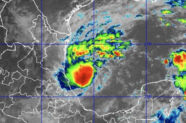
Where exactly the heaviest bands will set up Saturday and Sunday is impossible to say, but anyone watching in the watch area has the potential for 3-6” of rain throughout the weekend, with the heaviest downpours each afternoon and early evening.
Highs on Saturday and Sunday will be in the mid to upper 80s.
A Tropical Storm Warning is in effect for Pinar del Rio, Cuba. Tropical Storm Watches are in effect for Tulum to Rio Lagartos, Mexico