
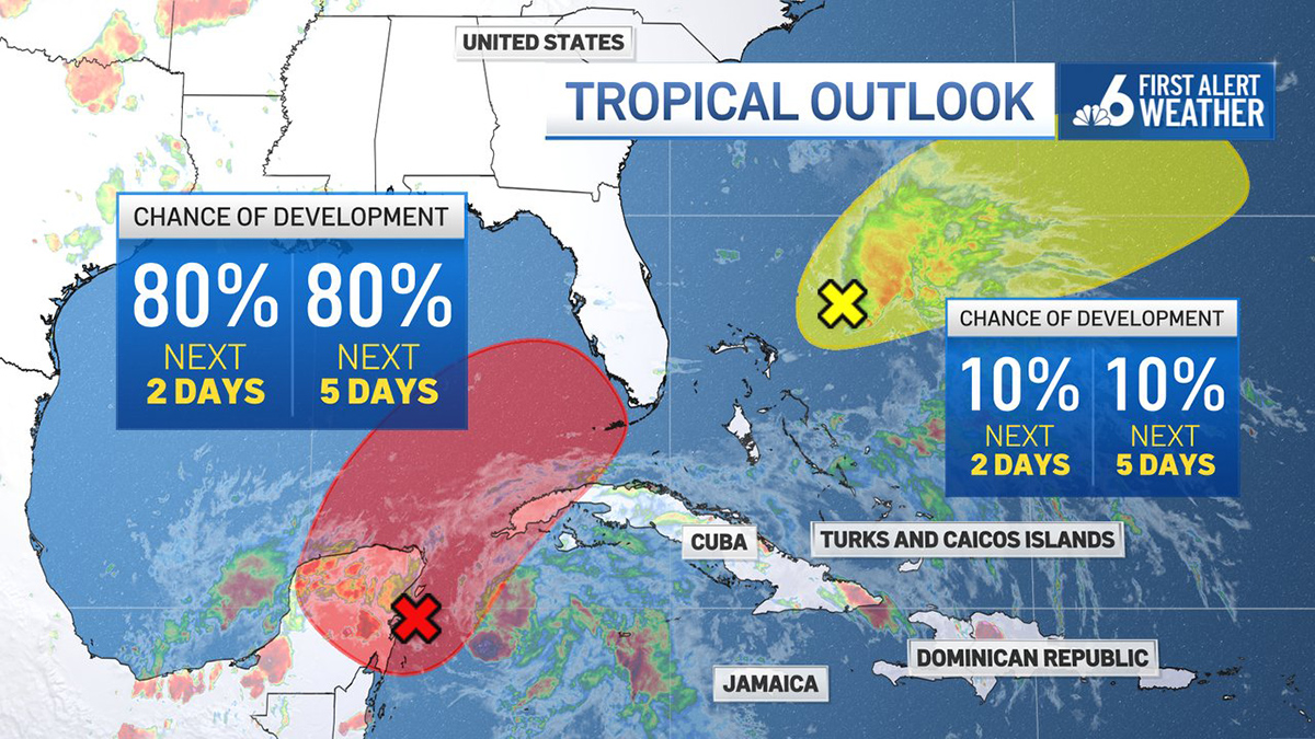
No depression or storm has formed yet, but the expectation from the National Hurricane Center is that one will form stemming for a disturbance still near the Yucatan Peninsula on Thursday morning.
That system — the remnant of an Eastern Pacific Ocean hurricane that slammed into Mexico on Monday — is expected to slowly start moving towards Florida by Friday, then accelerate as it passes the state and heads into the Atlantic.
There is high confidence that this new developing system won’t amount to much more than a depression or low-end tropical storm because of strong westerly winds in the upper atmosphere. This wind shear would make for a lopsided tropical depression or low-end storm in which almost all of the impactful weather would be displaced to the east of its center.
But rainfall forecasts are trending up. I’m seeing model output of as much as 10 inches in metro South Florida.
Get South Florida local news, weather forecasts and entertainment stories to your inbox. Sign up for NBC South Florida newsletters.
Hurricane Season 2022

My message continues to be to brace for flooding — which in recent years has become more severe because of global warming. Climate-related factors include a warmer atmosphere which can yield more extreme rainfall rates, and a higher water table because sea level rise continues to encroach upon South Florida.
Rainfall accumulation forecasts are also trending up because there is greater consensus among the models that the depression or weak tropical storm will track near but north of Miami and Fort Lauderdale. That would put all of metro South Florida and the Keys on the wet side.
The only saving grace would be that the system would be accelerating and hopefully passes quickly. But that may not be enough to keep us from seeing multiple inches of rain.
Locations in Florida north and west of the depression’s path wouldn’t get much precipitation, while those east and south of the center could see flash floods. For places like Tampa and Daytona Beach, just to pick two examples in central Florida, it could end up being a bright Saturday.

This track also places metro South Florida and the Keys in the region of the storm that is favorable for isolated tornadoes. All wind forecasts are at depression or low-end tropical storm level — meaning winds sustained at 40 mph or less.
But if a spin-up were to touch down, all bets are off. Even if the winds stay well below damage-inducing thresholds, some pockets of power outages will probably be observed.
CLICK HERE FOR THE 2022 NBC 6 HURRICANE SEASON GUIDE
The worst of the weather can be expected on Friday afternoon through Saturday morning. Some improvement may be seen as early as Saturday evening. Sunday looks pretty, with dry air being pulled from the North American continent southward across Florida while the system exits past the Bahamas northeast-bound into the Atlantic.
