
Fiona is the sixth name on the list of tropical storm names for this Atlantic hurricane season - one which has, so far, been quite underwhelming (not that I’m complaining).
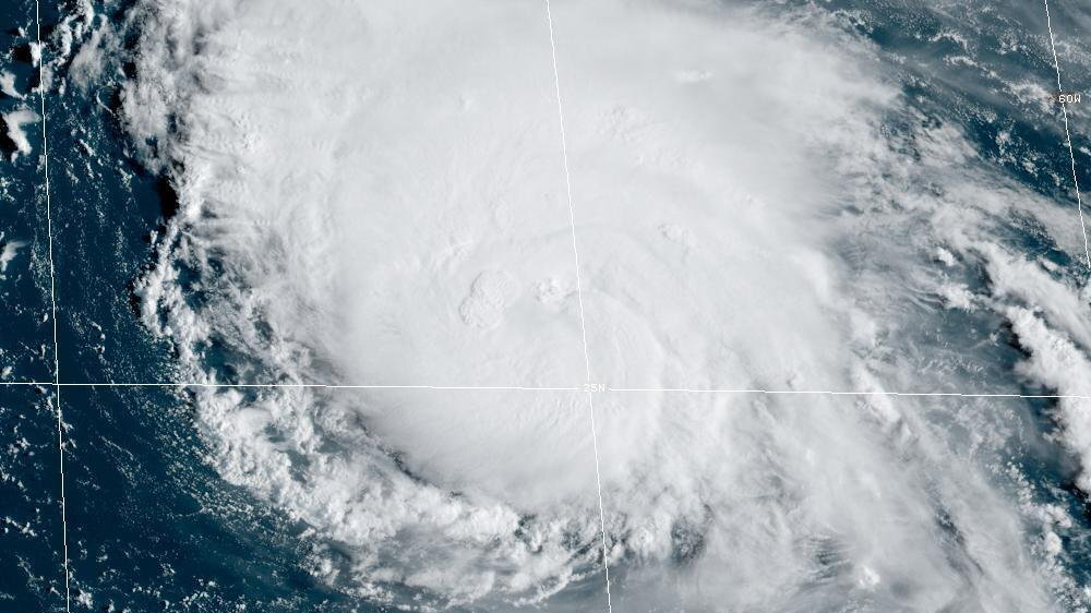
The seedling for this next potential tropical storm, dubbed Tropical Depression Seven, is in the main development region of the Atlantic Ocean. That’s the region in tropical belt between the west coast of Africa and the Caribbean from where most of tropical depressions form in August and September.
But this year, that area of the world has been overrun by dry air diving south from colder latitudes and mixing with areas of dust-laden Saharan air. Tack on a surprisingly stable atmosphere and frequent bursts of strong wind shear and storms have been lacking in 2022.
On Tuesday, dry air and less than favorable upper level winds seemed to be, yet again, killing chances for development. Satellite pictures Wednesday morning, however, showed that the disturbance was making a comeback several hundred miles east of the Lesser Antilles.
Get South Florida local news, weather forecasts and entertainment stories to your inbox. Sign up for NBC South Florida newsletters.
By mid-morning, the National Hurricane Center indicated that a new tropical depression had formed.
Hurricane Season 2022

Environmental conditions are far from perfect, and rapid intensification into a hurricane seems essentially impossible. But in the short term, we could indeed see that new depression or storm form and head in the general direction of the Leeward and Virgin Islands by Friday and to near Puerto Rico and the Dominican Republic this weekend.
Could it intensify further as it approaches those population centers? On the contrary, the main global weather model runs show it degenerating into a tropical wave when it’s passing Puerto Rico. That’s because what are now marginal conditions near the disturbance are expected to become hostile this weekend, with stronger west to southwesterly winds aloft that could decapitate a fledgling Fiona.
Though it is important to mention that when you run those models with slightly varying initial conditions - a method known as ensemble forecasting - you do get a few individual ensemble members keeping it as a viable tropical storm well into the Greater Antilles region.
For now, the most likely impact on Caribbean islands looks to be very heavy rain. Puerto Rico’s east half could see six or more inches of precipitation. The risk of flash floods will be elevated because this part of the island has seen the ground become saturated by the indirect effects of former Hurricane Earl, which kept a feeder band over the northeastern Caribbean even as it moved north past Bermuda.
There is another concern heavy on the minds of most Puerto Ricans (and this often applies to other Caribbean islands) - the fragility of the power grid. It wouldn’t take a hurricane to cause widespread power outages. Not a months-long Hurricane Maria type of outage, but one that could easily last days if not a week or more.
Beyond the Caribbean, the future of Tropical Depression Seven and whatever it might become is highly uncertain. Between the increasingly hostile atmospheric environment this weekend and potential interaction with the mountain ranges across the larger islands, there may not be much to see when it reaches the region between eastern Cuba and the eastern Bahamas next week.
Regardless, a dip in the jet stream and developing low pressure aloft offshore the southeast coast of the U.S. would help position a weak front from Florida to Bermuda which should help turn the system northbound and into the Atlantic next week.
